
![]() Deutschsprachige
Texte sind durch die deutsche Flagge markiert.
Deutschsprachige
Texte sind durch die deutsche Flagge markiert.
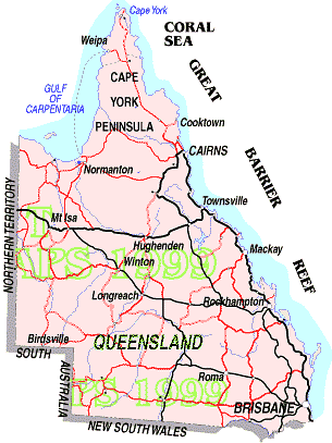
 Queensland
AREA: 1,723,936
sq. km., POPULATION: 2,625,000
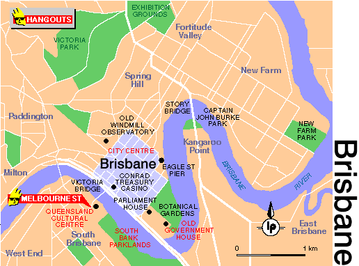
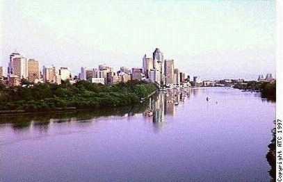
CAPITAL: Brisbane (1,200,000)
Queensland enjoys the self-appointed name of the
'Sunshine State', much of which is deserved for its
semi-tropical weather, thousands of kilometres of
beaches, and easy going life-style.
It may well be called the 'diverse' state, due to the
variety of landscape and climate which it constitutes.
In the north the tropical region has rain-forests,
gorges, islands, and massive rivers which cut access to
many places after rains. Being tropical it is also
cyclonic and the extremes of weather can be experienced.
In the south, the climate is more moderate with cooler
nights and clearer days. The state is divided east-west
by the Great Dividing Range which closely follows the
coastline. West of the range the 'Outback' is cattle
country with sparse vegetation and in the more remote
areas nights will be below zero in winter and days can
reach 50° in summer. Many of these regions are
criss-crossed by a network of rivers including the
Diamantina and Cooper Creek which can flash flood after
rains many kilometres away and isolate the lonely
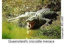
stations of the outback. The state is rich in primary
industry with copper and lead mines at Mount Isa, opals,
gold and precious metals around the state, bananas,
mangos and pineapples along the coast. peanuts at
Kingaroy, and all types of vegetables and fruits. A wine
industry is being established in the south near the
border. Queensland also contains several of Australia's
best known and visited tourist attractions in the Gold
Coast, and the Great Barrier Reef. In the far north Cape
York Peninsula and the Daintree Forest and gaining
increasing popularity, and the islands off the coast in
the reef are popular holiday destinations for millions
each year. Queensland is high on the list of places to
visit for international travellers and there is an
International Airport at Cairns in the north and Brisbane
in the south. A railway follows the coast between
Brisbane and Cairns.
| Brisbane | Jan | Feb | Mar | Apr | May | Jun | July | Aug | Sept | Oct | Nov | Dez |
| Temperature max. (C) | 29 | 29 | 28 | 26 | 23 | 21 | 20 | 22 | 24 | 26 | 28 | 29 |
| Temperature min. (C) | 21 | 20 | 19 | 16 | 13 | 11 | 9 | 10 | 13 | 16 | 18 | 19 |
| Rainfall (in mm) | 162 | 164 | 145 | 87 | 69 | 69 | 57 | 47 | 48 | 75 | 95 | 130 |
| Water Temperature (C) | 25 | 25 | 25 | 24 | 22 | 20 | 20 | 19 | 20 | 21 | 22 | 24 |
| Cairns | Jan | Feb | Mar | Apr | May | Jun | July | Aug | Sept | Oct | Nov | Dez |
| Temperature max. (C) | 32 | 31 | 30 | 29 | 27 | 26 | 25 | 27 | 28 | 29 | 31 | 31 |
| Temperature min. (C) | 24 | 24 | 22 | 22 | 20 | 18 | 17 | 18 | 19 | 21 | 21 | 23 |
| Rainfall (in mm) | 399 | 441 | 464 | 177 | 91 | 51 | 30 | 26 | 36 | 35 | 84 | 167 |
| Water Temperature (C) | 28 | 28 | 28 | 26 | 25 | 23 | 22 | 23 | 24 | 25 | 27 | 28 |
 In Vorbereitung